The Center of the Earth
|
Firstly, it is important to understand why the Centre of the Earth is significant.
According to ancient texts and manuscripts, the Centre of the Earth—also known as the Land of Elda*—is the location in the eastern hemisphere where Adam was created. This is not the Garden of Eden, but rather the region of the Earth where the Lord fashioned Adam’s body and where the first man stood upright for the first time.
Later, Adam was taken to the Garden of Eden, east of our earthly borders. There, he and Eve were tasked with caring for the Garden. They lived in the Garden for seven years, tending to it and feeding the animals outside, until the devil tempted them; they were then sent back to where Adam had been created, to the west of the Garden of Eden.
Note that the center or navel of the Earth is also known as Mount Zion or the Temple of the Spirit of the Lord.
Psalm 74:2 "Remember Your congregation, which You have purchased of old, The tribe of Your inheritance, which You have redeemed— This Mount Zion where You have dwelt."
Psalm 76:2 "In Salem also is His tabernacle, And His dwelling place in Zion."
Psalm 2:6 "I have installed My King on Zion, upon My holy mountain"
Isaiah 8:18 "We are for signs and wonders in Israel From the LORD of hosts, Who dwells in Mount Zion."
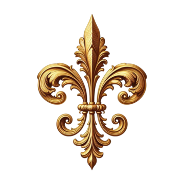
Fleur-De-Lys at the Centre
The lily symbolizes purity, as well as the strength and power found in a mother's eternal love for her child. Due to its beauty and rarity, the lily was already an important symbol in ancient Egypt and Greece. Its official use dates back to the early Middle Ages, when it was associated with Jesus Christ and the Virgin Mary, with its three petals representing the Holy Trinity, thus becoming a major religious emblem. Later, it became an emblem of monarchy and heraldry.

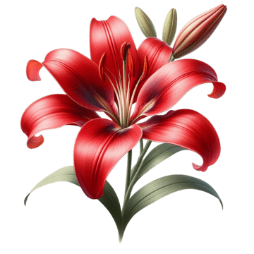

In ancient texts, such as the Second Book of Ezra it states that God chose the lily as his Own personal flower, and that flower represents Zion.
2 Esdras 5:24-25 "And of all lands of the whole world You have chosen for Yourself one region: and of all the flowers of the world You have chosen for Yourself one lily: And from all the depths of the sea You have filled for Yourself one river: and of all built cities You have set it apart and made Zion apart to Yourself." |The Book of Ezra|
We also find biblical verses that refer to the lily as a symbol closely associated with Israel.
Hosea 14:4-5 "I will heal their apostasy; I will freely love them, for My anger has turned away from them. I will be like the dew to Israel; he will blossom like the lily and take root like the cedars of Lebanon."
Songs 2:2-3 "Like a lily among thorns, So is my love among the daughters."
However, in virtually all maps prior to the 16th century, we can see the fleur-de-lis in the Centre of Africa. Furthermore, When we consult ancient maps dating from the 14th to 16th centuries, we find a multitude of maps inscribed on parchment, with wind roses and crossed rhumb lines. These wind roses were the basic elements used for navigation. Yet they all feature a very large compass rose at the center of Africa, indicating that this is not only the center of the Earth, but also the throne of a high priest. See the video below.
Interestingly, in Tabula X of his African maps in books 10 and 12, Livio Sanuto, the famous geographer to the king of the time, described the habits and customs of Africa and listed the names of all the populations of Ethiopia and Lower Ethiopia, referring to their territory as “Judaeorum Terra” in Latin, meaning “the Land of the Jews”. The map was published posthumously by his brother Giulio in 1588.

You be the judge, and we encourage you to do your own research.